Hell Canyon to Ensign Peak and the Radio Towers
hikers: Mark & Lecia
distance: not really sure. My phone died so strava quit recording! 8 miles, maybe more.
elevation gain: I don't know but it felt like a lot. My phone died at 1628 ft, so it was more than that!
I have wanted to hike to Ensign Peak from Hell Canyon for a while and so we did that today, on Halloween! We happened to be "in the neighborhood" after viewing a cute Halloween parade! After hiking to Ensign Peak, mark suggested going to the radio towers also, so we did. It was quite a hike! But I made it. There and back.
 |
| The cute Halloween parade. |
We parked in a neighborhood above the state capital and and walked up the road, through a gated entrance to a newer neighborhood, where the trail started.

There is also a trailhead on Victory Road. You park at the trail head on Victory road and head uphill. This is where the trails meet up.
It's a pretty view of the valley once you get up on the hillside.
 |
| You walk past the backyards of some large houses on your way to Hell Canyon. |

Hell Canyon is a small canyon with a well used trail that has a sharp drop-off on one side.
 |
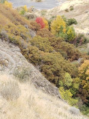
| There was some fall color in the canyon. |
After the canyon you come to a road that is used for service vehicles that go to the radio towers. You cross the road the trail continues with lots of switchbacks and eventually you come to a trail that goes to Ensign Peak. At that point we turned right and went to Ensign Peak. If you turn left it will take you to the Bonneville Shoreline trail and also to the radio towers. We didn't see many people until we started on the Ensign Peak trail.
 |
| View from Ensign Peak |
After coming back down from Ensign Peak Mark suggested going to the radio towers. He did this hike just a few months ago. So we headed off to the radio towers.

Instead of going back down to Hell Canyon we headed up this steep hill to get to the Bonneville Shoreline Trail. We followed the Bonneville Shoreline Trail and then turned off and onto a trail, not marked, to the radio towers.
This was my last photo before my phone died. Once we got to the top of the hill there was another hill in front of us!
A view of the Salt Lake Valley.
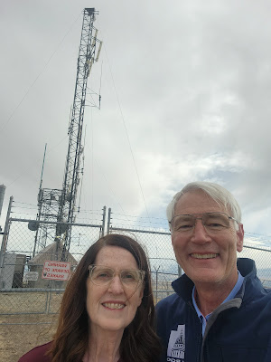
This was definitely a difficult hike for me and don't do it in the summer as there is no shade. On a crisp fall day, Halloween to be exact, that didn't matter because it was good weather for this hike. We hadn't seen any hikers but at the towers we saw a biker!!! I think he came up the service road.
After my complaining we headed down another way. It was not up and down, it was just down and that would have been a difficult hike going the other direction. So it is probably good we didn't go up that way. We eventually joined back to the Bonneville Shoreline trail, passed the fork for the trail we had taken on the way to the radio towers, and ended back at the Ensign Peak trail. We headed back towards Hell Canyon but instead of going through Hell Canyon we took the radio tower service road, until we got to the fancy neighborhood. There was a spur that took us between 2 houses and down to the trail on the hillside below the houses and we wound our way back to the car.
Since my phone died on the way up the hill to the radio tower, I don't have a complete map of where we went but this partially shows our path. This distance and elevation gain is also incomplete.
I didn't love this hike and wouldn't recommend it. But if I hadn't done it I would never have known that. It was a difficult hike and not really rewarding but its good to do hard things. I made it! I scouted out the trail and now I know to choose something else next time!


No comments:
Post a Comment