Tuesday, January 9, 2024

Monday, January 1, 2024 Butterfield Canyon

 Butterfield Canyon Road

hikers/walkers: mark and lecia

This was our "first day of the year" walk!  Happy 2024!  We went quite a ways, 7.2  miles to be exact with 824 ft. elevation gain according to strava, so I am including it as a hike.  We walked a couple a miles before there was even any snow and turned around at the 3.5 mile marker giving us the total of just over 7 miles out and back.   At the beginning there were more walkers and less the further we went.  It appears lots of people like to walk their dogs here.  There were also at least one runner and some people on bikes.  


The start is not so pretty but that's where the parking lot is and there's plenty of parking.


The stream goes from one side of the road to the other.  
There was a lot of watercress growing in it.


This is where we turned around.  The nice thing about walking in Butterfield canyon is the road is closed to cars this time of year.  By the time we turned around there was snow and it was a little colder.  On the road the snow is packed down from lots of use, including snowmobiles although we only saw their tracks. 


Saturday, November 18, 2023 Suspension Bridge

 Suspension Bridge and Bear Creek Loop

 from Hidden Valley Park


hikers:  Mark & Lecia

distance:  about 3 miles

We started at Hidden Valley Park and went on the Bonneville Shoreline trail and then on the way back we used the aqueduct trail.  The most commonly used trailhead is the Orson Smith Park.  The shoreline trail is longer and not as steep as the trail from the Orson Smith park and it has some fun rocks you hike by that really add to the hike.  We started this hike in September and never made it all the way to the suspension bridge.  This time we did it and even the loop to see the falls above!  By the time we got back we were walking in the dark!  Even so, it was a really enjoyable hike.


The rocks!  This part would be fun for the 
grandkids but the hike would be too long for them.


The falls you see from the upper bridge on the bear creek loop.  
Not a lot of water this time of year.


The colors are mostly gone.


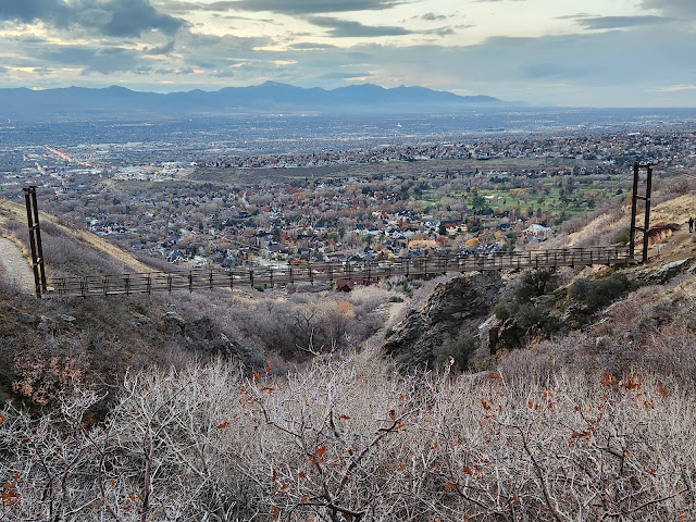
View of the suspension bridge and the valley from above. It is definitely worth hiking this loop up bear canyon a little further.  In spite of the lack of color this time of year we still had an enjoyable hike!  I liked getting in a longer hike from the trailhead we used this time.  After crossing the suspension bridge on the way back we went left and down to the aqueduct trail.  It took us back to hidden valley park but is lower than the shoreline trail. It went right behind the homes in that area. We hadn't been on this trail before and it was dark but it is a well worn trail and we used the flashlight on the phone.


Monday, January 8, 2024

October 16,17 2023 Three hikes in Shenandoah National Park

 Shenandoah National Park

Mark, Seth, and I spent a couple of days exploring the north part of the park and while there we did 3 hikes: 

Stony man Overlook

Dark Hollow Falls

Rapidan Camp.


Stony Man Overlook

length:  1.5 miles

elevation gain: 321 feet

We parked at the Stony Man parking lot and set out on the Appalachian Trail.  The Appalachian Trail goes thru the park and we were able to hike on it a little ways.  


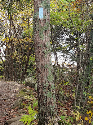
There are blazes on the trees to tell you what trail you are on.  They are a vertical rectangle painted on the tree at eye level.  The color corresponds to the trail it is on.  


  At the intersection we went on to the Stony Man trail to get to the overlook.  You end up on a large rocky area and you can see for miles.  I


This was a good hike to go on.  We got to do a bit the Appalachian trail, it looked like the rest of the trails in the area, and the overlook was amazing.


Dark Hollow Falls

From a parking lot by Skyline Drive we hiked down a utility road, a fire road, to get to the falls.  It was an easy walk, and there were other families with young kids on the trail.  We got to some falls and it was pretty then we headed up the hill to some other falls.  


The falls were beautiful although busy, but we got a photo.  
We took one for someone and they took one for us.  


After leaving these falls we took a different trail back, the Dark Hollow Falls Trail.  This was a steep trail.  This section doesn't show it, but we seriously wondered if some of the other hikers were going to make it.


Look!  We saw a deer! From the Dark Hollow Falls trail we followed 
the Skyland Big Meadows Horse Trail back to where we were parked.  


Rapidan Camp

The next day we hiked to Rapidan Camp.  I thought it sounded interesting and I'm so glad we went! Rapidan Camp was the summer home for President and Mrs. Hoover during his presidency.   We started at the Milam Gap Trailhead and took the Mill Prong Trail. The colors were beautiful on this trail.  The leaves on the ground were like colorful confetti.  It was about 3.7 miles, 748 elevation gain.  


One of the unique trail markers.


The  trail goes through the forest.  Lots of it is flat 
like this but there are definitely some ups and downs.


Here are some of the beauties along the trail.


On the left you can see some small falls we passed.


The bridge over the creek.


Rapidan Camp was the summer home for Herbert and Lou Hoover while he was president.  This was just before it was Shenandoah National Park.  The Hoovers had lots of money and he didn't accept a salary as president.  They paid to build the camp. (1929ish) It isn't fancy by today's standards but it was a lovely place.  Not everything is still standing but we were able to tour his cabin and one other.  We also hiked up Camp Hoover Road a ways.  The Hoover's cabin was called The Brown House and there was a tour guide to show us through.


                            The Brown House (instead of the White House!)


Exploring near the camp. Then we took the same trail back to our starting point.


It was a beautiful hike through the forest and interesting history at Rapidan Camp.  It was nearly 4 miles plus the time we spent there, but I'm glad we had time for it.


Sunday, January 7, 2024

Friday, October 6, 2023

 Rocky Mouth Falls

Hikers:  us, Landon and his crew, Daniel and his kids

Distance:  .7 miles

Elevation gain: 282 feet

Rocky Mouth Falls is a very family friendly hike and it is a go to, with or without kids, because it is close, quick and a rewarding hike with waterfalls at the end. The small parking lot fills up but there is parking on the road.  All trails calls it moderately challenging.  That is probably not based on the distance but on the fact that it is all uphill.  The first half is walking through a neighborhood and then you are going up the mountain.  Stairs at first and then a trail.  The reward is the falls at the end.  


These are the stairs that take you from the parking lot to the neighborhood.


Now we are on the trail, with the kids being carried.  


Exploring the falls!  There's not a lot of water this time of year but its always cool by the falls and a good place to explore.  It looks like we color coordinated for photos but it was just coincidence!


Saturday, January 6, 2024

Saturday September 30, 2023 Hidden Valley Park south on Bonneville Shoreline trail

Bonneville Shoreline Trail south from Hidden Valley Park

Hikers: Mark and Lecia

Distance:  20 minutes out and 20 minutes back.  Not sure how far that was.

The idea was to hike from Hidden Valley Park to the Bear Canyon Suspension Bridge in Draper on the Bonneville Shoreline trail.  But this was between conference sessions and there wasn't time to go all the way.  We parked at Hidden Valley Park and made our way to the Shoreline trail from there and headed south.  We hike about 20 minutes and turned around.  We passed a few people on the trail.  


A very pretty section of the trail.  


The trail goes down some stairs and then you cross over this cute little bridge.  


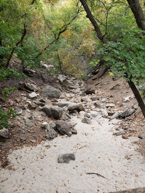
No water in the creek!


This is the view of the valley from where we turned around.  
According to a map that green area is the Hidden Valley Country Club.


There were a few patches of fall!
We will definitely have to do this again when we 
have time to go all the way to the Suspension Bridge.


Friday, January 5, 2024

Saturday, August 5, 2023 Cecret Lake

 Cecret Lake

hikers: just us, as it seems to be on most hikes we do these days!

distance:  4.5 miles, out and back

elevation gain:  1210 feet

mosquito population on the trail:  trillions

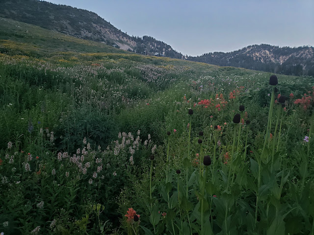
We hiked to Cecret Lake from the parking lot at Alta, right before the toll booth!  This meant we didn't have to pay, we got a longer hike, and we hiked through the wildflowers!  Win, win, win.  The wildflowers might or might not have been at their peak but if it wasn't their peak it was sure close.  And there were lots of people taking photos.  

There is a parking lot just before the toll both.  The trail starts at the edge of the parking lot between the Albion Grill and the Ski School building.


As you head towards the ski lift you see a sign pointing the way to Cecret Lake.


Starting out there were some areas were ropes along the 
trail to keep people on the trail and out of the wild flowers.


After the wildflower meadows we eventually found ourselves on a utility road instead of the trail.  There were some steep parts, and lots of mosquitos!  They were eating us alive.  I know people use that phrase to mean a lot of mosquitos but they really were eating us alive!  Some other hikers offered us mosquito spray and I gladly used it.


That's one of them on my wrinkly skin.  I lost count of how many there were.
You can see where one of them got me on my leg.  They attacked anything that wasn't covered.


We found our way to the Cecret Lake trail and made it to Cecret Lake.


There were lots of people at the lake but by the time we got back to 
where we started there weren't many hikers  and it was almost dark!